
Geosurvey, classify, deliver

A cloud in. Every deliverable out.

Terrain, contours, sections and volumes; classes you teach it yourself; linework drawn on the cloud — and scene layers your GIS opens. Each result says how far you can trust it.

cloud.contours · traced from airborne lidar

Livein your browserdrag to turn it

A classified survey,in your hands.

Colour it by what the scanner saw, by class, by height or by contour lines computed here and now.

    Autzen Stadium · Watershed Sciences, Inc., via PDAL/data, CC BY 4.0

    Esri I3Sscene layer packagesread and written

    A city from your GIS,and back to it.

    Scene layer packages open in the scene, streamed like everything else — and the application writes its own from any mesh, checked before it is handed over.

    OpenScene layersIntegrated meshes and point-cloud layers, streamed a node at a time.
    WriteAny mesh to SLPKA level-of-detail tree with compressed geometry, in the coordinate system of the scene.
    CheckValidated before hand-overThe package is read back and checked node by node before you send it on.

    classify.runClassifydrag the line

    Teach it your classes.Then check its work.

    One press gives every point a class with a model trained inside the application. Click a few trees and it finds the rest; points it is unsure of stay unclassified, and it says how many.
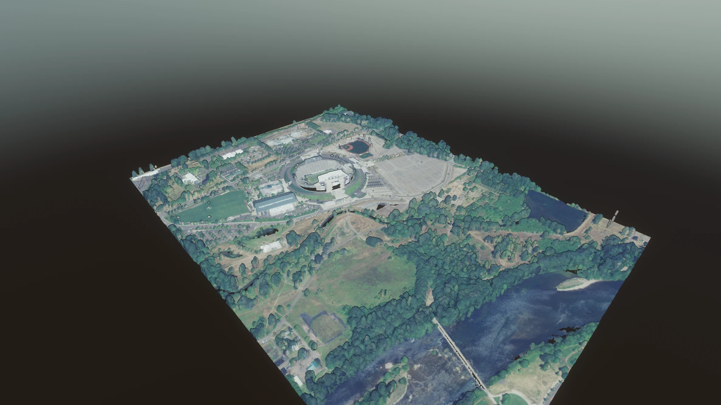
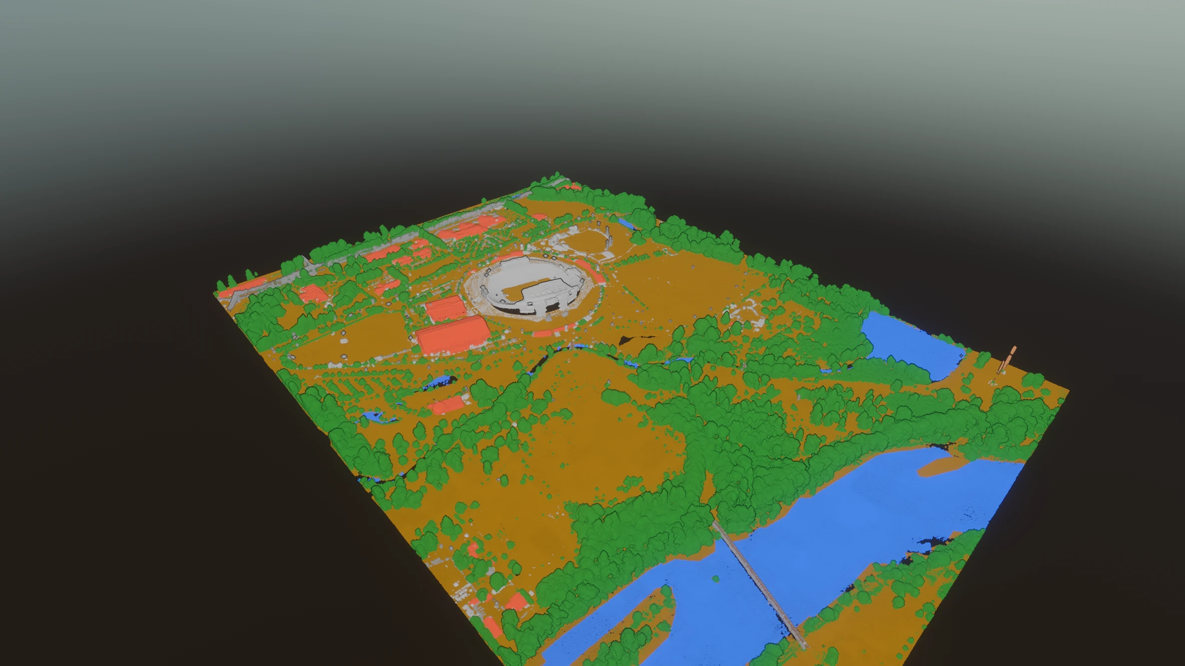
    An airborne lidar survey of a stadium, its car parks, woodland and river, in the colour the survey recorded The same survey by class: ground ochre, vegetation green, buildings red, water blue As surveyedBy class

    Autzen Stadium, airborne lidar, captured in the application · Watershed Sciences, Inc., via PDAL/data, CC BY 4.0

    survey.deliverThe order

    One order,every deliverable.

    Pick a survey type and the order fills itself: what to make, at what interval, from which class. Change one setting and everything that depends on it updates together.

    cloud.surfaceTerrain modelBare earth from the ground class, gridded at a cell size derived from the data; holes stay holes where nothing was measured. GeoTIFF out.
    cloud.contoursContoursAt the finest interval the survey can carry — and it says what that is. DXF and DWG, a layer per kind.
    cloud.sectionsSections and profilesDown a measured line, and across it at intervals, each one drawn rather than tabulated.
    cloud.volumeCut and fillAbove and below a stated datum, reported separately, each with its own error bars.
    cloud.deviationCompare two surveysM3C2, with the level of detection propagated from the sensor model rather than guessed from roughness.
    vector.tool.*Linework on the cloudBreaklines, kerbs, outlines and ridges drawn in the cloud — in stereo if you have the display — each carrying its residual and tolerance into the DXF.
    cloud.export_reportSurvey reportThe surface, the contours, the volume with its error split into random and systematic, and every finding — as a PDF.

    Studieson measured geometryin preview

    Studies you wouldbuy another program for.

    Built on the same measured geometry, judged against named standards, and honest about their own uncertainty.

    model.sunstudySun and shadowHours of direct sun per surface on the measured geometry, judged against DIN 5034-1 and EN 17037, with a day you can drag.Preview
    model.sightlinesSight distanceOn the road you actually measured, against AASHTO and DMRB CD 109; the obstruction is named and placed.Preview
    model.viewshedViewshedWhat a camera or an observer here can see — graded in IEC 62676-4 bands by what could be recognised.Preview
    scanplan.runScan planningWhich stations will measure every surface to tolerance, and where to stand for the ones that will not.Preview
    geo.monitorMonitoringDid it move, is it moving, and could we have told — epochs, a congruency test and the smallest detectable movement.Preview

    Accuracyyou can read

    It says how faryou can trust it.

    Registration by least-squares network adjustment, with the reliability figures surveyors are taught and rarely shown. Every deliverable is badged with where its accuracy came from — stated, derived or assumed.

    What it does not do yet

    No vendor-native scanner formats (RCP, LGS) and no plug-in inside AutoCAD or Revit.

    No geoid or vertical-datum grids yet; heights stay in the file's system.

    Classification is trained mainly on airborne data; on mobile and indoor scans, check its work.

    A German interface arrives before INTERGEO 2027.

    Geo comes withCapture inside it.

    From €1,490 a year, €179 a month, or €3,490 perpetual with a year of updates. Per seat, excluding VAT. Draft prices.